


Sva jednostavna rešenja počinju velikim idejama
Šta predstavlja INOVA?
Najveća vrednost INOVA rešenja su akumulirana domenska znanja s područja telekomunikacija, elektro mreža, saobraćaja, prostornog uređenja, urbanizma, ekologije i geodezije. Ta znanja, u kombinaciji sa originalnom topologijom, te web, on site i mashine learning tehnologijama su kreirala sofisticirane ekspertne sisteme.
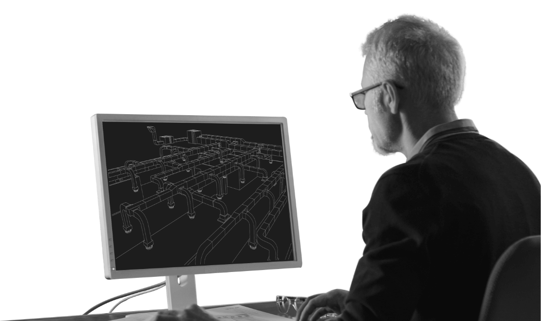
Telekomunikacije
Treba da projektujete optičku mrežu ili da optimizujete postojeću bakarnu mrežu? Možda Vam je potreban „Life-cycle management” za vašu poslovnu organizaciju.

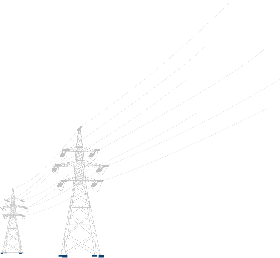
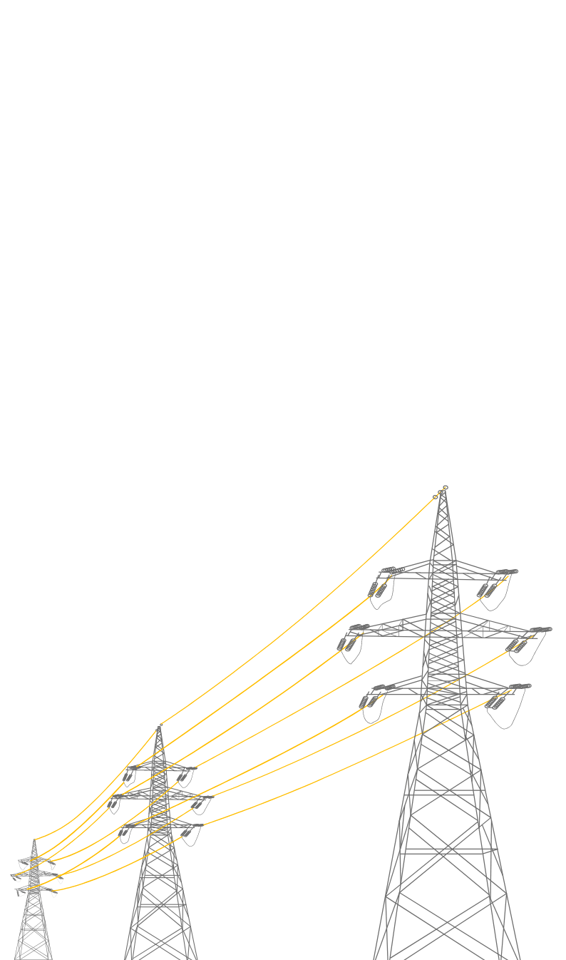
naponska mreža
Bavite se planiranjem, projektovanjem i održavanjem elektroenergetskih mreža? Jednostavno rešenje je ElectroCAD-GIS platforma zasnovana na Autodesk AutoCAD Map 3D i Civil 3D paketima.
Putna infrastruktura
Efikasno održavanje putne infrastrukture zahteva upotrebu adekvatnog softverskog rešenja za prikupljanje i obradu podataka, ekonomske i strukturalne analize. Rešenje je RoadCAD-GIS.

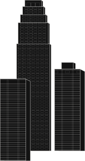
Urbanizam
Za efikasno planiranje prostora, održavanje katastarskih podataka, kao i komunalnih infrastrukturnih mreža u upotrebi je AreaCAD-GIS platforma zasnovana na Autodesk AutoCAD Map 3D softveru.

Autodesk - softver za vašu viziju
Bilo da se bavite inženjerskim, dizajnerskim ili poslovima iz oblasti medija, Autodesk ima rešenje za vas. Prodaja licenci, trening centar, sertifikacija i tehnička podrška – paket usluga na jednom mestu – GEOINOVA.
Saznajte više
Novosti
Sve novosti
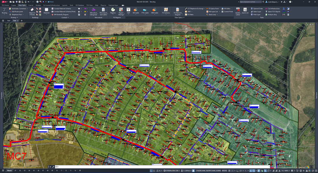
TeleCAD-GIS 2024 - Šta je novo?
Najbitnije novine i unapređenja koje donosi verzija TeleCAD-GIS 2024: Dijagram optičke mreže Dijagram mikro cevi Prikaz pripadajuće glavne cevi na svakoj adresi Automatsko dodeljivanje boje omotača mikro cevima u zajedničkom rovu Automatsko vezivanje vlakana Selektovanje TCG objekata Detektovanje problema na trasi Digitalizacija trase Uvoz u TCG Izvoz iz TCG Prilagođeni modovi rada za izabranog operatera Numeracija elemenata mreže u skladu sa modom rada Izveštavanje u skladu sa modom rada Priprema za štampu Upravljanje prikazom elemenata u skladu sa modom rada Android aplikacija TCG Assistant TeleCAD-GIS 2024 donosi i podršku za rad na android platformi. Za razliku od prethodnih verzija koje su koristile web pretraživače kao platformu, nova verzija sada dolazi kao Android aplikacija. Omogućava offline rad, što je velika prednost kad se nalazite na terenu. Aplikacija, u ovoj verziji, omogućava ažuriranje podataka preuzetih iz TeleCAD-GIS-a ili GIS baze kao i prikupljanje novih podataka na terenu. Pored standardnih TeleCAD-GIS osobina koje je moguće ažurirati ili kreirati, sada je moguće i napraviti jednu ili više fotografija, dodati napomenu, ažurirati status (npr. kad je reč o izgradnji) i dodati komentar. Uz svaku promenu automatski se evidentira datum i vreme. Web help se nalazi na lokaciji. Instalacija se može preuzeti sa link-a.
Pročitajte više
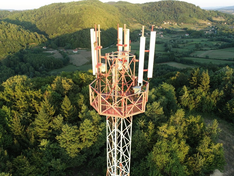
Upotreba drona u inspekciji telekomunikacionih stubova
GeoINOVA poseduje svu neophodnu dokumentaciju za izvođenje letačkih operacija, koja obuhvata potvrdu o evidenciji drona, polisu osiguranja i sertifikate za pilote. Softver za obradu snimaka je Pix4D koji omogućava precizne rezultate, jednostavne analize i održavanje dokumentacije ažurnom. Neke od osnovnih funkcionalnosti su: kreiranje tačnih 2D mapa i 3D modela od slika; merenje rastojanja, površina i zapremina; dodavanje napomena; generisanje profila nadmorske visine; izvršavanje virtuelnih inspekcija i mogućnost deljenja snimaka sa drugim zainteresovanim stranama. Specifikacija je dostupna putem link-a. Pomoću ovih tehnologija, odnosno digitalnih replika, moguće je dobiti detaljne informacije o stanju teško pristupačnih objekata telekomunikacione infrastrukture, kao što su stubovi. Samim tim, dobija se ažurna evidencija o njima: oprema koja je instalirana i koji prostor je na raspolaganju za iznajmljivanje. Najveće prednosti ovakvog načina rada su: 75% brže prikupljanje podataka, automatski popis sredstava i smanjenje vremena inspekcije za 80%.
Pročitajte više
Učešće na XI međunarodnoj naučnoj konferenciji STED u Trebinju
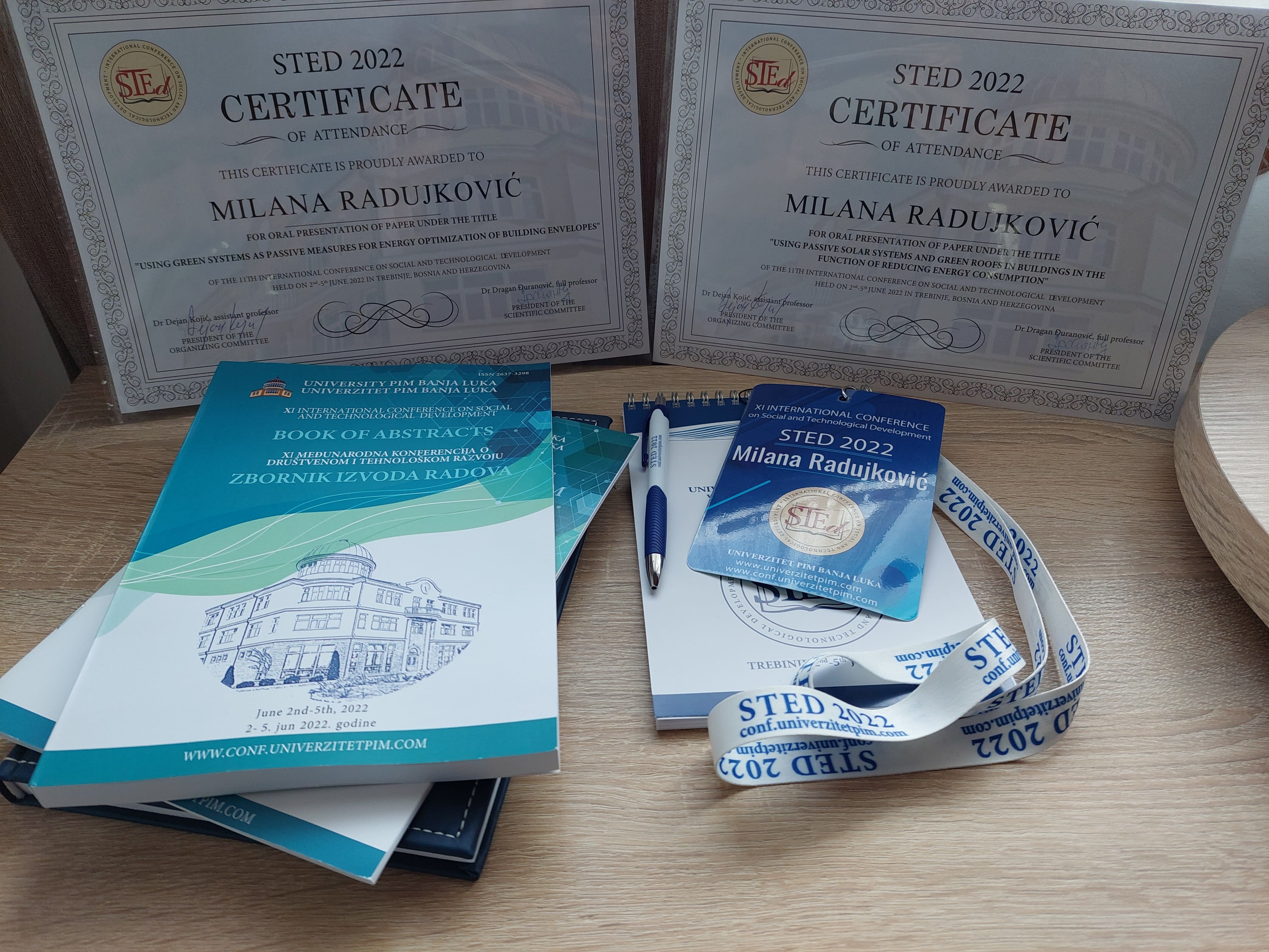
Naša koleginica i izvršni direktor, Milana Radujković, u okviru doktorskih studija učestvovala je na međunarodnoj naučnoj konferenciji o društvenom i tehnološkom razvoju koja se održala u Trebinju, od 02. do 05. juna ove godine. Tom prilikom govorila je o upotrebi pasivnih solarnih sistema i zelenih površina u zgradarstvu u funkciji povećanja energetske efikasnosti stambenih zgrada. U istraživačkom radu koristila je Autodesk Revit softver sa Insight nadogradnjom za energetske analize i došla do interesantnih podataka o uštedama energije i smanjenju emisije CO2 na godišnjem nivou. Više o samom istraživanju i analizama možete pogledati u Zborniku izvoda radova koji je objavljen na zvaničnoj web stranici konferencije: http://conf.univerzitetpim.com/wp-content/uploads/2022/06/Book-of-Abstracts_2022-1.pdf Ovom prilikom osvojila je nagradu za najbolju usmenu prezentaciju u oblasti „Ekologija, energetska efikasnost i zelena energija“. Čestitamo koleginici na postignutom uspjehu i zahvaljujemo se organizatorima na pozivu za učešće i predivnom iskustvu tokom boravka u Trebinju.
Pročitajte više
Naših TOP 10 najvećih Autodesk klijenata u Bosni i Hercegovini (APS Engineering)
"Mi smo APS Engineering - kompanija sa fokusom na oblast fasadnog inženjeringa u okviru koje nudimo konsultantske usluge, usluge projektovanja, inženjeringa, proizvodnju i isporuku fasada, fasadnih pozicija i elemenata. Naš tim sačinjen je od stručnjaka iz oblasti arhitekture, građevinarstva i mašinstva i isti se kroz godine iskustva specijalizirao da svoje znanje i iskustvo primjeni u oblasti fasadne industrije. Vrlo rado ističemo i saradnju sa renomiranim sistemskim kućama poput Reynaersa, Aliplasta, Alumila, Aluprofa i mnogih drugih. APS Inženjering je osnovan 2007. godine i od tada smo kroz godine napornog rada, korak po korak bliži samom vrhu fasadnog inžinjeringa, što nam jeste krajnji cilj. Zajedno sa našim klijentima i partnerskim kompanijama širom svijeta, stvaramo izuzetne projekte smještene u svjetskim metropolama poput Londona (UK), New Yorka (SAD), Frankfurta (DE), Amsterdama (NL) i mnogih drugih gradova širom svijeta. Naš kvalitet prepoznat je na tržištu Engleske prvenstveno, a zatim i Holandije, Sjedinjenih Američkih Država, ali i na tržištu drugih zemalja. Prosječna starost našeg tima je 35 godina, što znači da smo kompanija koja mladim ljudima daje priliku da rastu zajedno s nama."
Pročitajte više

20 godina INOVAcija
Pre 20 godina smo potpisali prvi ugovor sa telekomunikacionom kompanijom kojoj je bila potrebna jedinstvena slika mreža i sistema kojima upravlja. Ponudili smo inovativno rešenje: integraciju CAD i GIS alata, tj. razvoj «pametnog» FM sistema kao temeljne IT podrške procesima planiranja, projektovanja, održavanja i upravljanja telekomunikacionom infrastrukturom. Ponosni smo što je ta kompanija i posle 20 godina jedan od naših najvažnijih partnera.
Danas smo partneri sa više od 400 kompanija, organizacija i uprava. Većina njih upravlja ili učestvuje u finansiranju održivog razvoja prostora u celini i specifičnih infrastrukturnih sistema.

Naši partneri
INOVA je zvanični zastupnik/distributer sledećih kompanija:
INOVA saradnje

Najveći telekom operater u Srbiji. Koristi INOVA GIS Platformu za održavanje svoje mreže optičkih kablova, bakarne mreže i mreže zaštitne kablovske kanalizacije.

Telenor je telekom operater u Srbiji koji koristi INOVA GIS Platformu za održavanje svoje mreže optičkih kablova.

EMS upravlja transportnom visokonaponskom energetskom mrežom, a koristi INOVA GIS Platformu za održavanje svoje optičke mreže izvedene podzemno, vazdušno i putem OPGW kablova.

Najveći korisnik Autodesk softvera u Bosni i Hercegovini. Nudi usluge iz oblasti grejanja, klimatizacije, ventilacije, tehničkih planova, precizne klimatizacije, automatike i centralnih nadzornih sistema.

Telekom operater Republike Srpske (BiH). Koristi INOVA GIS Platformu za održavanje svoje mreže optičkih i bakarnih kablova, te mreže zaštitne kablovske kanalizacije.
Telekom operater Crne Gore. Koristi INOVA GIS Platformu za održavanje svoje mreže optičkih i bakarnih kablova, te mreže zaštitne kablovske kanalizacije.

EPS upravlja distributivnom visokonaponskom energetskom mrežom, a koristi INOVA GIS Platformu za održavanje svoje optičke mreže izvedene podzemno, vazdušno i putem OPGW kablova.

SBB je Srpski internet i kablovski operater. Koristi TeleCAD-GIS za održavanje svojih mreža izvedenih optičkim kablovima.

Blicnet je lokalni internet provajder na području grada Banja Luka (BiH). Koristi INOVA GIS Platformu za održavanje svoje mreže optičkih kablova.

Telrad Net je lokalni internet provajder prisutan na području grada Bijeljina (BiH). Koristi TeleCAD-GIS za održavanje svoje optičke mreže i mreže zaštitne kablovske kanalizacije.
Vaše ideje
INOVA rešenja počinju velikim idejama. Recite nam svoje. Kontaktirajte nas na email ili telefon.